NCCP - Western North Carolina Hurricane Helene Impact Assessment
Overview
This project focuses on assessing the impacts of Hurricane Helene on Western North Carolina. The assessment includes a high-level analysis of storm impacts, ranking of affected counties, pre-Helene conditions, and key considerations for recovery and future resiliency efforts.
Context
The analysis leveraged data from multiple authoritative sources, including NOAA, NWS, NC State Climate Office, Duke Energy, NC Forest Service, and NC Department of Agriculture. We validated affected areas and conducted a lookback study using Census and NC Commerce Department data.
Impact Summary
- Most Impacted Counties: Buncombe, McDowell, Henderson, Rutherford, Transylvania, Polk, Yancey, Mitchell, Avery
- Damage Types:
- Power Damage: Severe damage to infrastructure with complex repair zones identified.
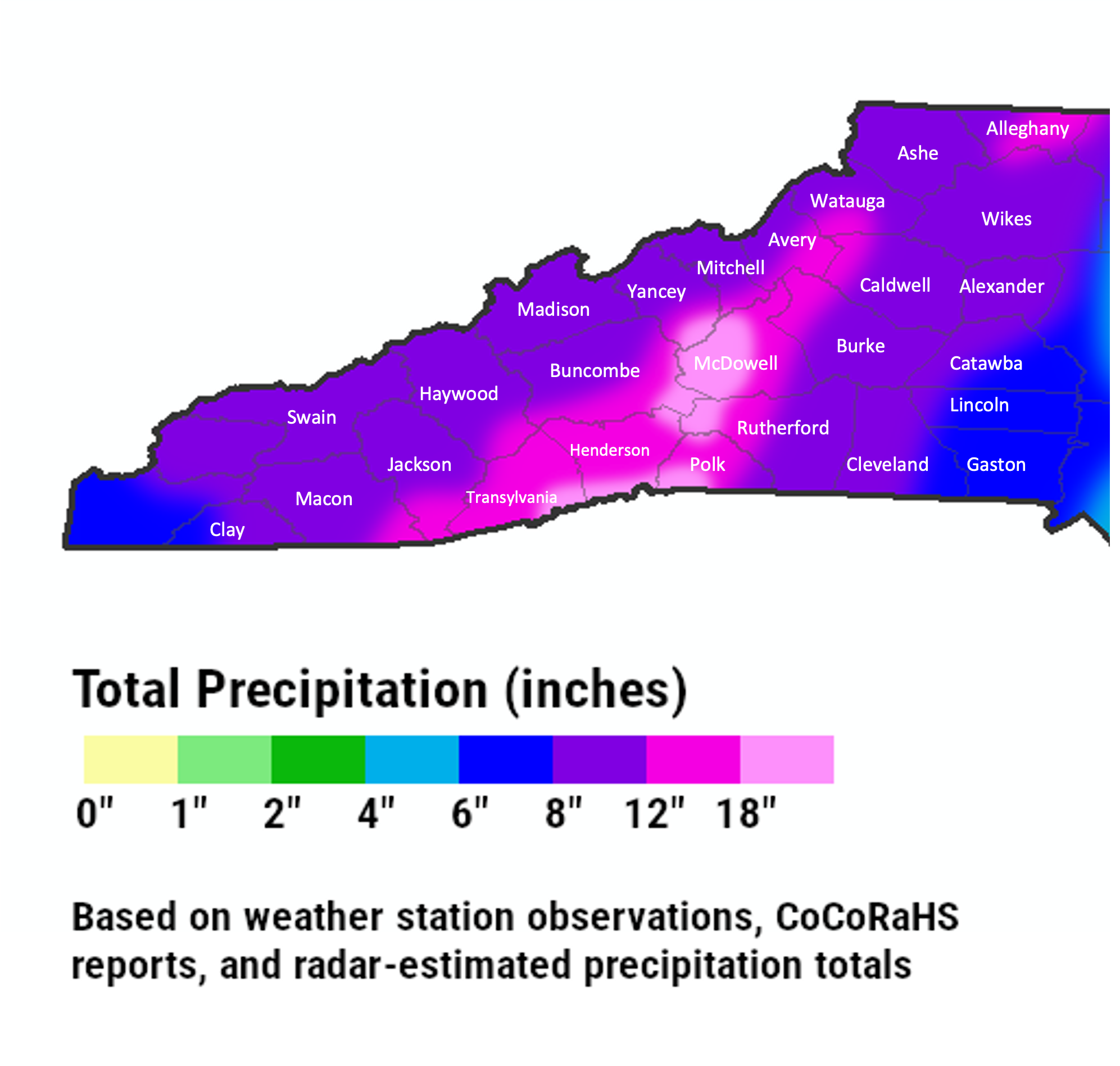
- Forest Damage: Six counties suffered heaviest damage, notably McDowell (130,805 acres) and Buncombe (89,440 acres).
- Flooding & Landslides: Especially in Yancey, Avery, and McDowell Counties.
Lookback Analysis
Pre-Helene, counties exhibited varying levels of resiliency based on:
- Demographics: Some counties had high renter concentrations and aging populations.
- Income & Poverty Trends: Mixed income growth rates and poverty decline patterns.
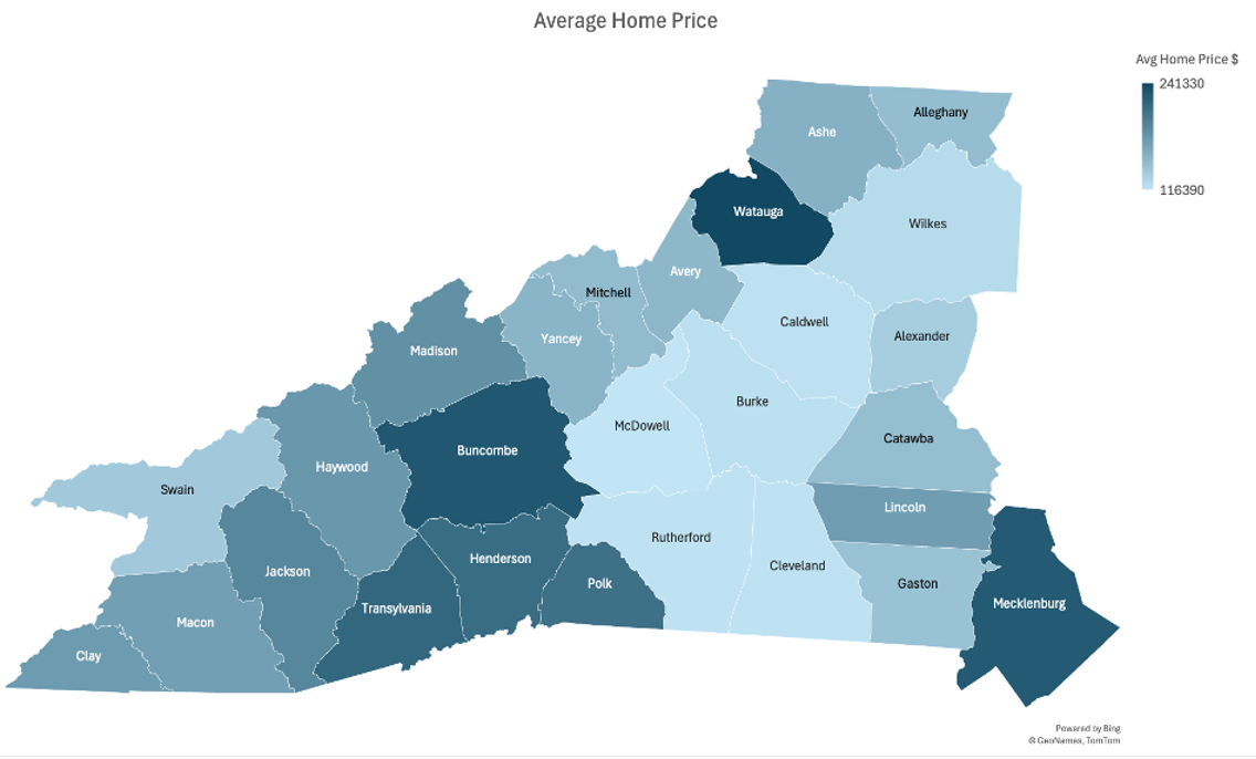
- Housing Indicators: Several counties experienced slow home value growth and high rent burdens.
- Business Composition: High ratio of small businesses (<$500k annual sales) in severely impacted areas like Mitchell and Yancey suggests vulnerability.
Business Impact
- Businesses were mapped based on size and geographical concentration.
- Areas with high small business ratios are considered less resilient.
- Infrastructure and power outages heavily affected small businesses, especially in rural and mountainous regions.
Go-Forward Considerations
- Data Buildout: Infrastructure resilience, economic health, vacancy rates, and migration patterns post-Helene.
- Program Identification: Map available federal, state, and local funding programs.
- Strategic Actions:
- Support vulnerable populations.
- Revitalize local businesses.
- Improve resiliency against future disasters.
- Implement anti-fraud measures.
Impact Summary
Map showing the most impacted counties with complex repair and disaster rebuild zones.
Lookback Analysis
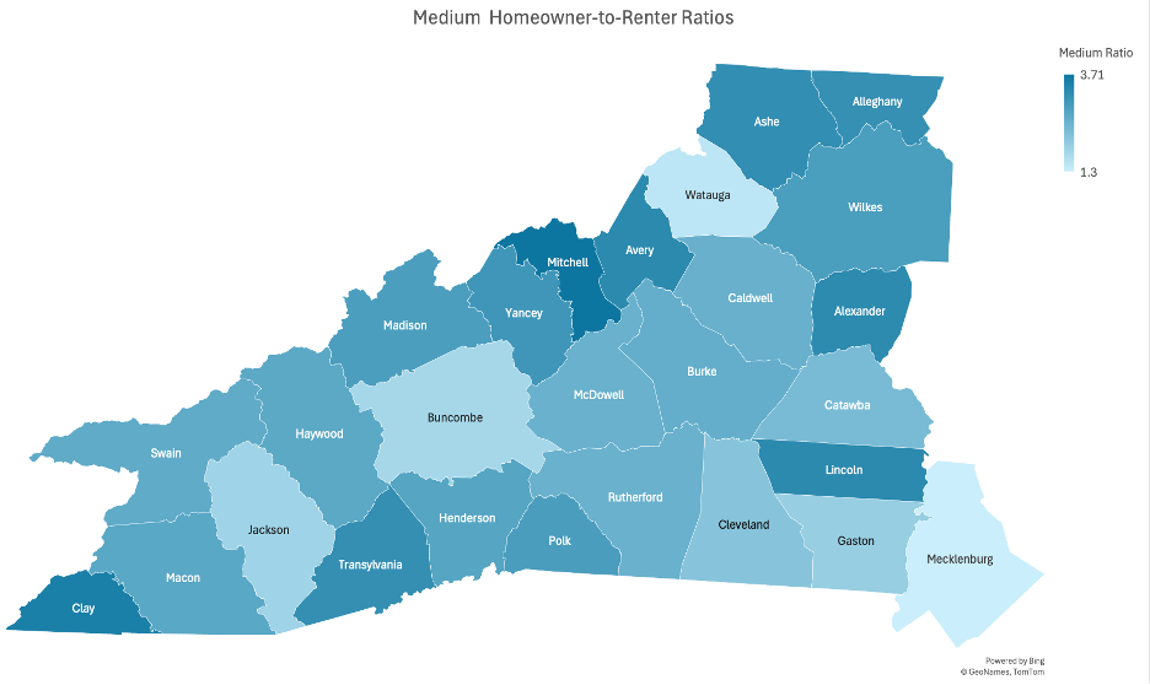
Chart showing owner-to-renter ratios, home value growth, and rent burden across counties.
Business Impact
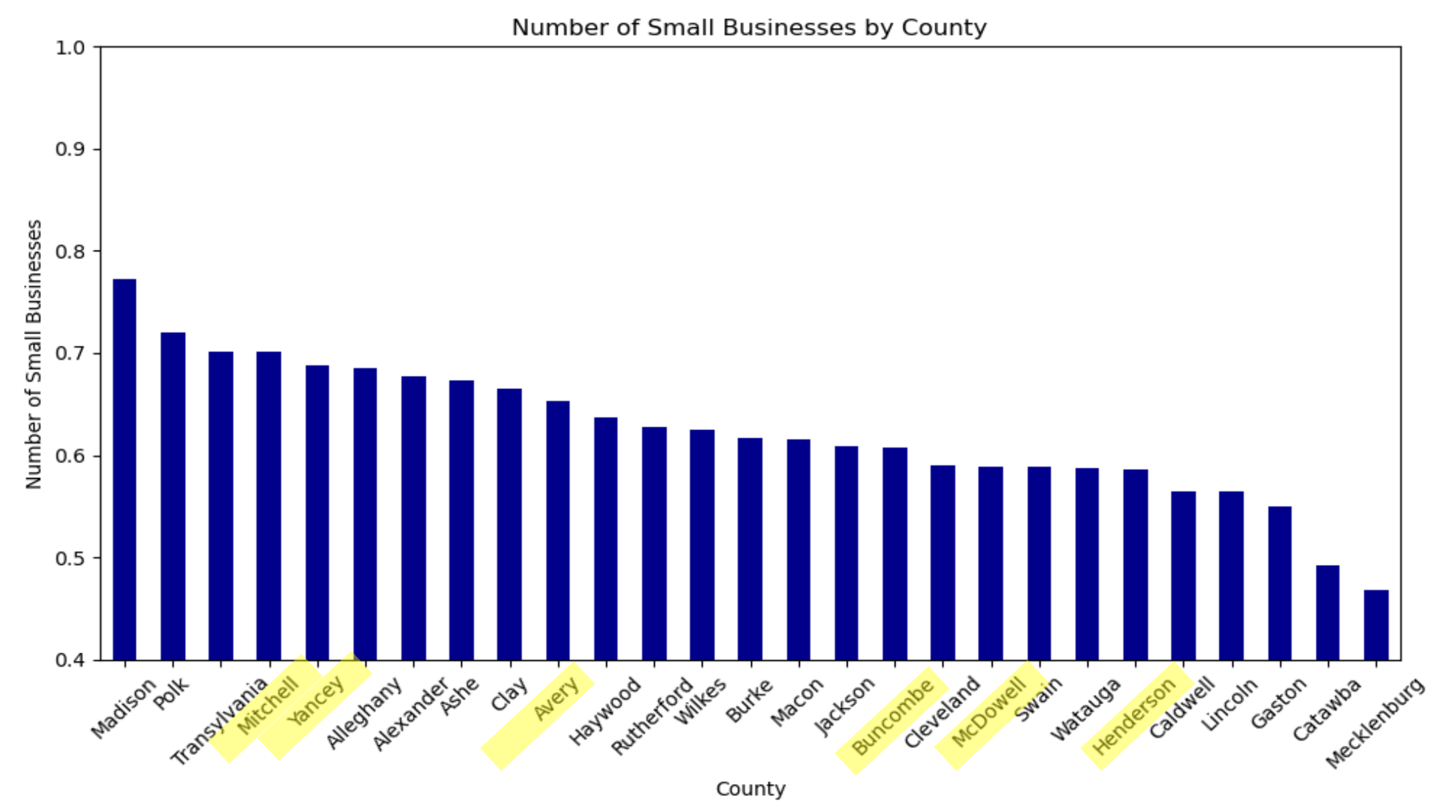
Graph illustrating the distribution of small and large businesses and their impact on resilience.
Go-Forward Considerations
Framework summarizing key considerations for policy and funding initiatives post-Helene.
Forest Damage Overview
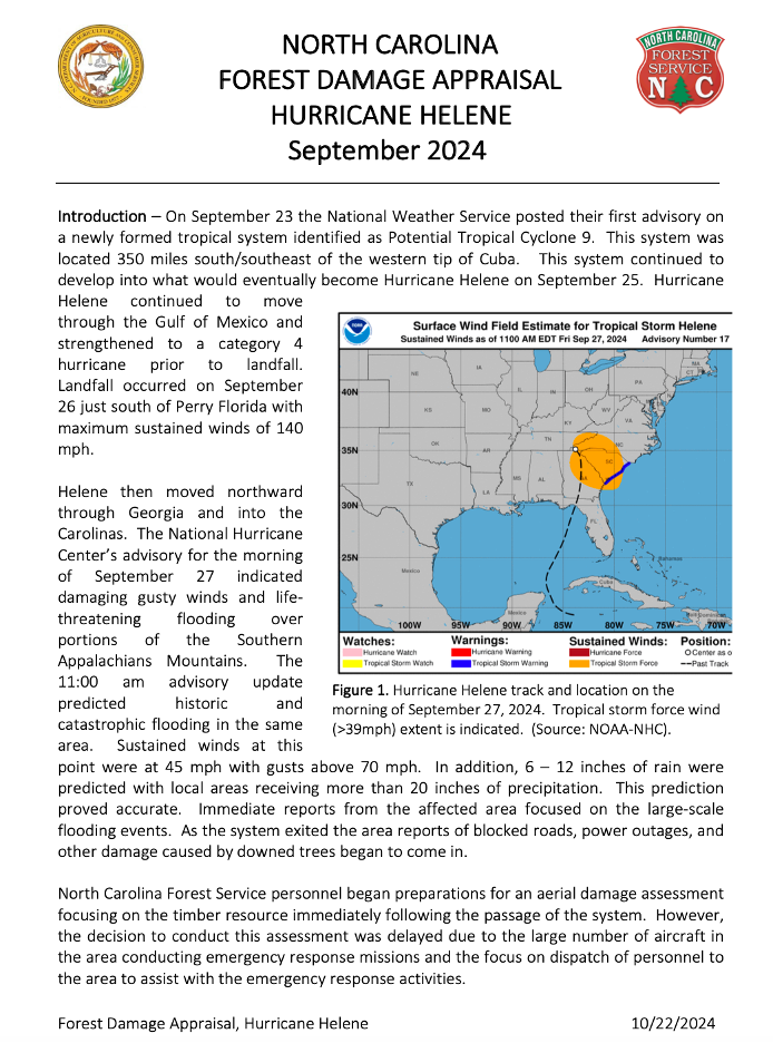
Forest damage areas across impacted counties.
Forest Damage Details
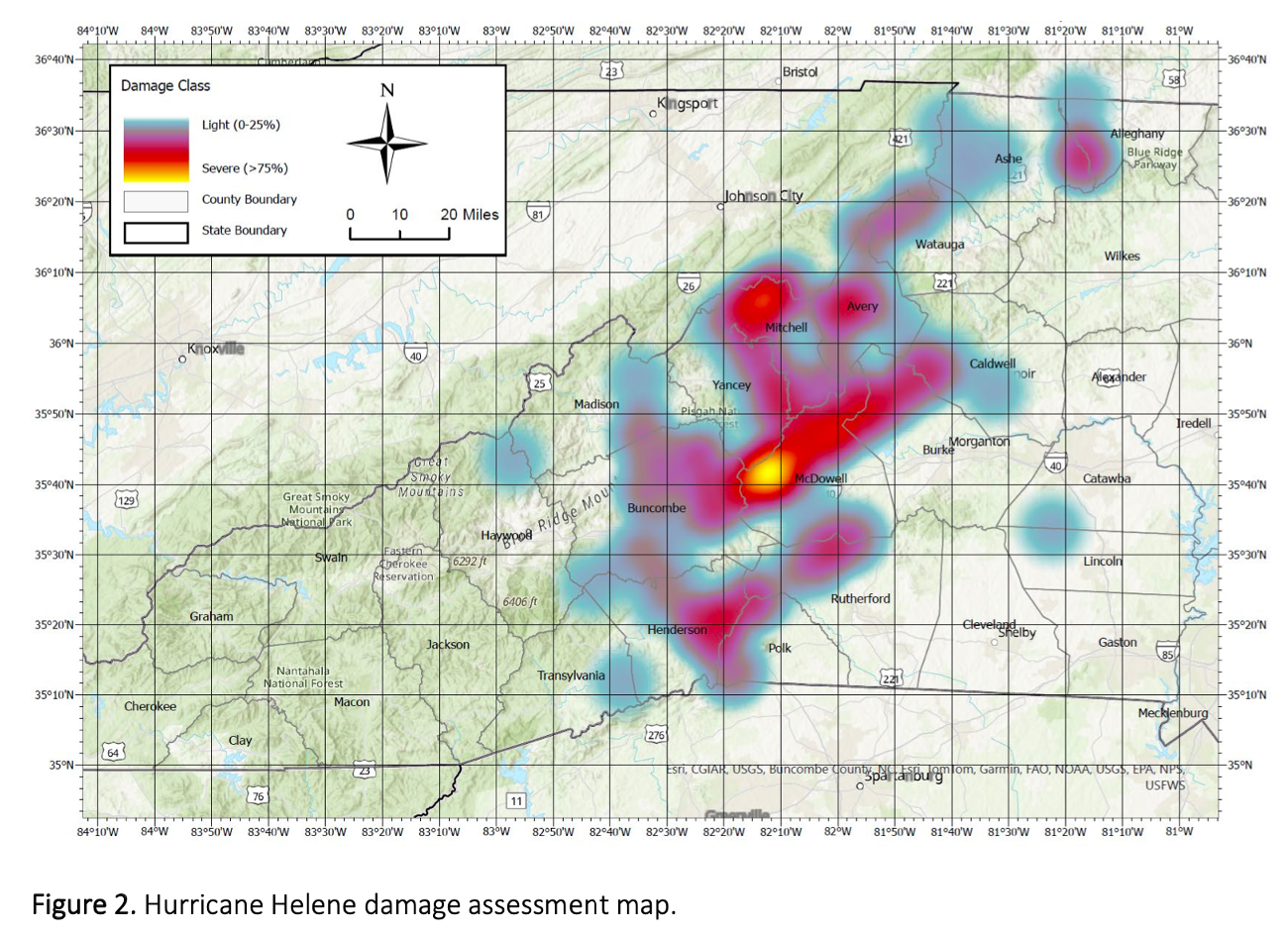
Detailed breakdown of forest damage in Western NC.
Home Value Growth
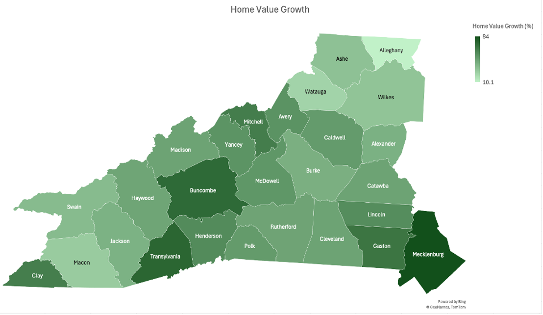
Chart showing home value growth trends by county.
Home Price to Income Disparity
Disparity between home prices and median income.
Rent Burden
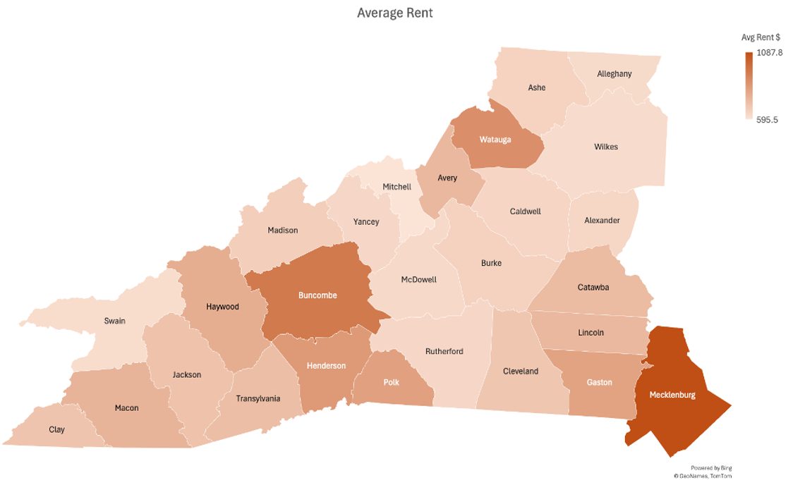
Percentage of population facing high rent burdens.
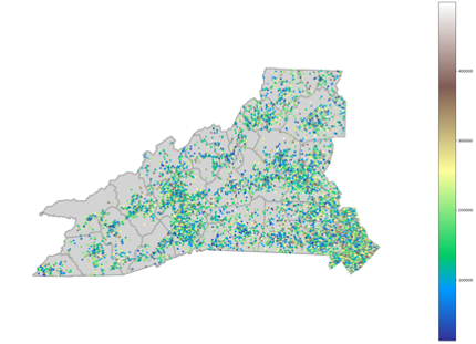
Large Business Distribution
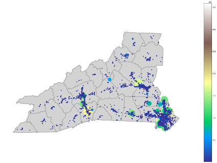
Distribution of large businesses across impacted counties.
Power Infrastructure Damage
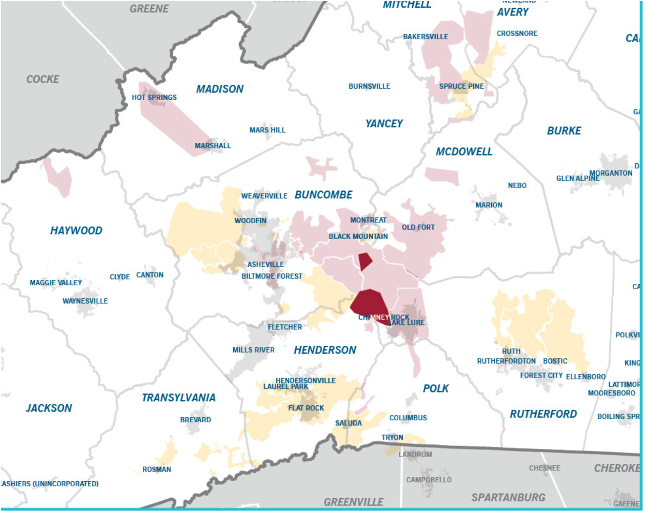
Map showing power infrastructure damage zones.
The original slides
PDF preview unavailable in this view. Please download instead: